
A public servant who worked as an educator, a surveyor, and a judge, James Thompson used his talent for precision to shape the towns and roads of Illinois, creating communities and connections that are some of the state’s most thriving areas today.
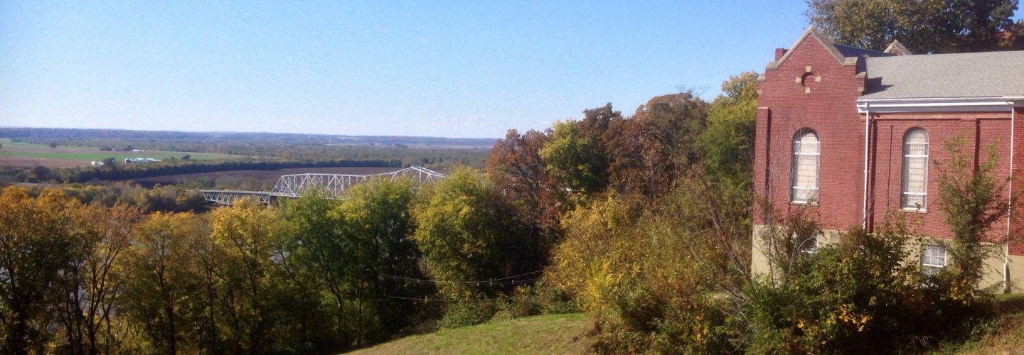
Born in 1789 in Abbeville, South Carolina, James Thompson was the son of John Porter Thompson and Mary Glasgow Thompson. His family was part of a community of Scots-Irish immigrants who settled in the area in the years shortly before the Revolutionary War. After the war, many of the Thompson family’s friends and relatives decided to go west, traveling to Randolph County, Illinois (which was then part of the Indiana Territory). In 1802, families from Abbeville established a new settlement in the central part of the county, on the eastern bank of the Kaskaskia River near the mouth of Plum Creek. Often called the “Irish Settlement,” the community was quickly populated by numerous people with Abbeville connections, including the Patterson, Huggins, McClinton, Anderson, Hill, Cox, Campbell, Beattie, McDonald, and McBride families. The new residents of this part of the county were often called the “South Carolina Irish.” The men and women who resided in the Irish Settlement were praised as energetic, patriotic, and respectable, infusing a new sense of “life and activity” in the area.
In 1804, two of James’s uncles, Archibald and James Thompson, arrived at the Irish Settlement with their families. Ten years later, James and his brother, Samuel, followed suit. In 1814, the brothers traveled from Abbeville to Kaskaskia, where 25-year-old James took a teaching position. He educated the children of Kaskaskia for three years, leaving the post when he married his Uncle Archibald’s daughter, Margaret Thompson, in October 1817. The couple settled on a farm in Preston, not far from the original Irish Settlement, and raised twelve children.
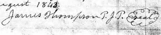
But farming wasn’t James’s ultimate calling. His reputation as a reliable, responsible citizen – and as a capable surveyor – quickly led him to a career of public service. In 1820, he was named as a county commissioner, serving in the post until 1821. During his time as commissioner, James took both the federal and state censuses for Randolph County, certifying the state enumeration on November 27, 1820, and the federal enumeration on January 6, 1821. The same year, he was appointed a United States surveyor, working for the United States Surveying Service for more than two decades. He also served several terms as a county surveyor.
Residents of Randolph County were already familiar with James’s skilled surveying work. In 1819, he had surveyed the Kaskaskia and Covington Road, connecting Randolph County’s citizens with the people of St. Clair and Washington Counties. According to work done by historian Frank Moore in 1902, the road took travelers from Kaskaskia to the village of Florence (New Palestine), then headed northeast through Lively Prairie (near Central) and Hill Prairie (near Tilden). The road crossed the county border near Marissa and ended in the village of Covington in Washington County. Ever the perfectionist, James resurveyed and platted the road in 1831. But by 1902, the road was already long gone; Moore wrote that it “has been abandoned for years and only old traces can be found and seen where it passed through Randolph County.”
In 1824, James was responsible for establishing another important local road, linking the state’s first two capitals. He platted and surveyed the State Road from Kaskaskia to Vandalia. James used the homesteads of his own family, as well as those of his extended family and friends, as stops along the way. The new road also traveled from Kaskaskia to New Palestine, and Moore traces it “thence in a northeasterly direction, crossing Little and Big Nine Mile Creeks; thence to John Miller’s; thence to Archibald Thompson, Sr.’s; thence to Judge James Thompson’s; thence to William Mann’s; thence crossing Little and Big Plum Creeks; thence to John McBride, Jr.’s; thence to the Randolph County line; thence to Vandalia, Fayette County.” In February 1833, the state legislature compensated James for continued work on the road, directing the state auditor to pay him about $54 for his work.
James was also responsible for finalizing one of Randolph County’s boundary lines. In February 1830, he worked with J. Milton Moore, the surveyor from Monroe County, to establish the boundary between Randolph and Monroe Counties, a project that came at the request of the state legislature. Only a few months later, though, James took on another major project, one that would become his greatest legacy. He was hired by the Illinois and Michigan Canal Commission, an organization in the northern part of the state that was building a canal between Lake Michigan and the Illinois River, to survey and plat two towns, one on either end of the planned canal. First, he and his crew laid out the canal’s planned western terminus, the town of Ottawa (originally called “Carbonia”) in La Salle County, finishing on July 5, 1830. Then, they packed up and headed for the canal’s planned eastern terminus: a sparsely-populated location near Fort Dearborn at the mouth of the Chicago River.
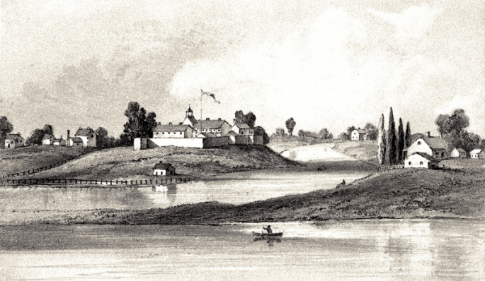
In 1955, the Chicago Tribune imagined how the site must have looked when James arrived there and began his survey in July of 1830. They pictured “Thompson, a booted and bearded man of 41, standing outside his Chicago camp on that summer evening 125 years ago. He likely had followed the usual practice in beginning his survey at its northeast corner; the camp therefore would have been about at the present corner of State and Hubbard Streets. With the map in hand, Thompson could follow with his eyes the row of stakes and markers stretching south and west [through] the fat wet fields. The first row on his right was Dearborn Street, because he had decided that was to be its name.”
James and his crew laid out a neat grid of streets on a site near Fort Dearborn, covering less than a square mile of land. Their newly-planned town of Chicago didn’t reach all the way to the shores of Lake Michigan, because government land occupied by the fort sat between the lake shore and the new town. Instead, the boundaries of James’s Chicago formed a neat rectangle, with a fork in the Chicago River sitting nearly at its center. The town’s straight streets measured 66 feet wide – the exact length of a surveyor’s chain. One of the perks of surveying and platting the town was that James got to name those new streets, most of which still bear the same names today. Randolph Street, named for James’s home county, stretches across the southern portion of the plat. He also named streets after Fort Dearborn, the Des Plaines River, the explorer George Rogers Clark, and William Wells, a soldier who died in the Fort Dearborn Massacre in 1812. Water and Canal Streets were reminders of the commission that had employed him to complete the project.

For years, though, citizens of Chicago apparently thought that James had named many of the city’s streets, including Washington and Jefferson, after American presidents. The Tribune noted, “Early city councils of Chicago, as they added streets beyond the limits of Thompson’s plat, assumed they were following his lead in giving the east-west streets the names of presidents. No one seems to wonder why Thompson did not give the name Adams, instead of Madison, to the street immediately south of Washington.” But James hadn’t been thinking of presidents at all when he had named these Chicago streets; instead, he had taken the opportunity to honor his own home region, naming them after the counties of Southern Illinois. Along with Randolph, James used the names Washington, Madison, Franklin, Clinton, Jefferson, and Union for Chicago’s streets.
But although James took care to commemorate his part of the state in the plat map of Chicago, the Tribune doubted that he knew just how important this survey really was: “Beyond the sluggish current of the main branch of the river, some soldiers were loafing about the stockade of the government reservation. Thompson had little reason to think that the town he had just finished plotting would have a great destiny. Maybe it would have no destiny at all; the growing western country was then full of hypothetical cities, some of which never amounted to anything.” After all, there were far more people already living and thriving in downstate Illinois. (Grover Brinkman later noted in the St. Louis Post-Dispatch that “only 32 voters were listed on the register” when James did his survey of Chicago.) After the plat map was completed on August 4, 1830, James left Chicago, which was still merely “Lake Michigan howling on one side and prairie wolves on the other,” to return to Randolph County. He turned down the canal commission’s compensation offer of several acres of property in the newly-platted town, preferring instead to take $300 for his work.
In 1831, James took on an additional role, becoming Randolph County’s probate judge. His eye for detail and commitment to precision were both extremely helpful in this role, especially when dealing with the complex estates of some of the county’s earliest families. During his seventeen years as a judge in the probate court, James handled estates of both the state’s first governor, Shadrach Bond, and the state’s first lieutenant governor, Pierre Menard. He remained Randolph County’s probate judge until the new state constitution of 1848 changed the jurisdiction of probate cases in Illinois.
Two years after completing the Chicago survey, James also briefly found himself in a very different line of work. He served first as a lieutenant and then as a captain of the Third Regiment of the Third Brigade of the Illinois Mounted Volunteers during the Black Hawk War in 1832. The regiment that he led was made up largely of volunteers from the Irish Settlement, near his home of Preston. The regiment was formed in June 1832 and mustered out on August 17, 1832.
Back in Randolph County, James found himself busy surveying and platting towns that were significantly more populated than Chicago, including Sparta and Chester. He surveyed and platted the village of Rockwood on January 20, 1836; less than a month later, he finished the plat map of the town of Steele’s Mills, later known as Steeleville. Surveying became something of a family business for the Thompsons. James’s brother, Samuel, also worked for the United States Surveying Service. By this time, some of James’s sons had also joined him in his surveying work. John and Archibald worked with him on projects in McHenry County in the 1830s; he also surveyed parts of Kane and DeKalb Counties during this period. Another son, James D. Thompson, followed in his father’s footsteps, becoming a county surveyor; so did James Thompson Douglas, one of his sons-in-law.

James served in numerous public roles during his life, and the author of one county history notes that he did so with ease: “In all these stations he discharged his duties in a manner that won universal satisfaction.” Even so, James was always best known for his surveying work. The same historian added that “whenever the name of James Thompson is mentioned, the idea of surveying is suggested. His foot has probably made its impress upon every section of land in Randolph County.” James died in Randolph County at the age of 83 on October 6, 1872, outliving many of his contemporaries – and even almost outliving the city of Chicago, which was ravaged by the Great Fire of 1871. (About half of Thompson’s originally platted area burned; the river stopped the fire from spreading to the western portion of the original city. Thompson’s original plat map, held at the Chicago Historical Society on the corner of Dearborn and Ontario, was also a casualty of the blaze.)
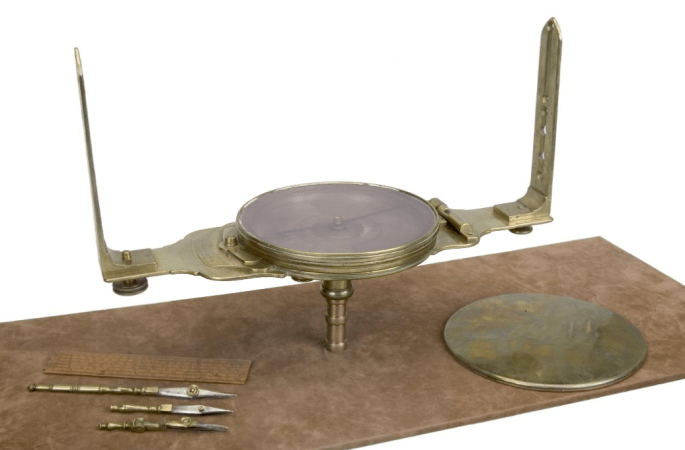
The Chicago Tribune recognized his role as the city’s creator in an obituary published a few weeks after his death: “James Thompson, lately deceased in Randolph County, Illinois … was in early life a surveyor, and plotted the first town lots around old Fort Dearborn, now the City of Chicago.” By the time James died, more than 40 years after he created Chicago’s original plat map, the population of the city had swelled to a remarkable 300,000 citizens. By the end of the nineteenth century, it was one of the largest cities in the world. But its citizens never forgot James Thompson. The Chicago History Museum proudly holds the surveying equipment that James used to establish the original town’s boundaries, and the city celebrates August 4, 1830, as one of its important milestones. A hundred years after Thompson finished his plat, newspapers remarked upon the anniversary: “Chicago, second-largest city of the United States, is 100 years old today. On August 4, 1830, the river-mouth, marshland settlement known as Fort Dearborn, became Chicago through the publication of James Thompson’s village plat.” In 1930, Chicago’s Real Estate Board also marked the anniversary when they ran a contest, giving away local parcels of land to those who wrote them to tell them why they’d like to own a piece of Chicago. James’s great-great-niece, Edna McCormick Williams of Murphysboro, Illinois, took third prize – a small plot of land in the suburb of Wheaton – in part because she “enclosed with [her] answer an old newspaper clipping showing that [her] great-uncle, James Thompson, drove the first surveyor’s stake for the platting of the original village of Chicago.”
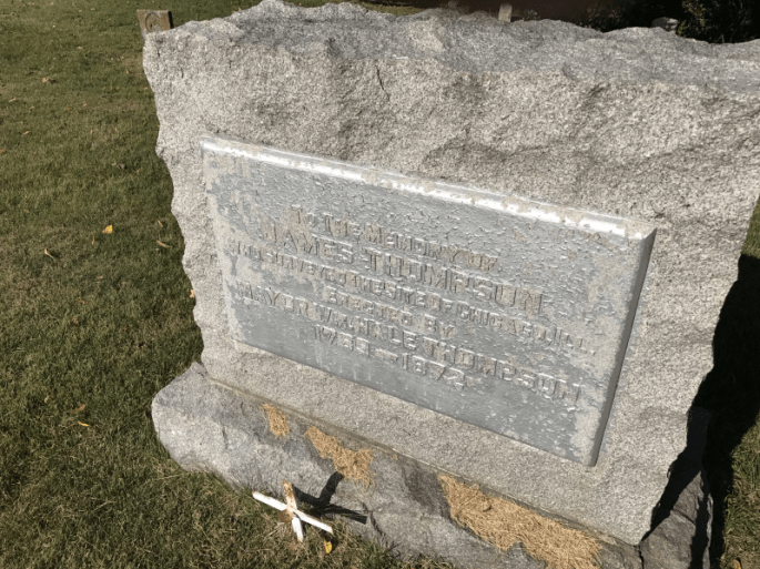
James was buried in the Preston Cemetery, a modest burial ground in the middle of Randolph County. Grover Brinkman wrote in the Post-Dispatch in 1986 that it “seems ironic that the body of the man who ‘ran the first line’ in what became Chicago’s Loop should rest in this isolated, weed-grown cemetery.” But the people of Chicago provided a special monument to remind the people of Randolph County that James helped to create the state’s biggest metropolis. Almost half a century after James’s death, William Hale Thompson, who served twice as Chicago’s mayor, erected a marker at his grave in Preston; Brinkman joked, “One might say it was a tribute from one Thompson to another.” The monument was a fitting tribute, honoring the person that the Chicago Tribune once called an “unquestionable and identifiable founder” of the city of Chicago.
The monument at James Thompson’s grave has fallen into disrepair in the decades since it was placed, and later attempts to improve it have only further obscured the marker’s message. With the bicentennial of the city of Chicago on its way in a little more than a decade, a restoration would be an appropriate project, especially in our state’s bicentennial year. Of course, James’s greatest legacy isn’t a marker in a cemetery; it is the enduring communities in Illinois that he helped create and connect. As one Chicago reporter put it, “James Thompson has another monument, a really spectacular one. If you wish to see it, stand anywhere along the main branch of the Chicago River, and look about you.”
James Thompson was inducted into The Randolph Society in 2018.
